
South Africa is heading into summer with a potentially powerful weather wildcard. Scientists say the 2026/27 El Niño is already established and intensifying, with warnings of possibly significant impact on weather patterns around the world.
Expect a summer of extremes
On 10 September, the US Climate Prediction Center put the probability of a very strong El Niño event at more than 90%, with a 75% chance that the October – December event could reach historic strength.
For Southern Africa, El Niño is often associated with:
- Below-average summer rainfall;
- Higher-than-normal temperatures;
- Increased risk of drought;
- Pressure on agriculture, water resources, and food prices.
Locally, the South African Weather Service (SAWS) issued its latest Seasonal Climate Watch on 31 August 2026. Its key points are:
- For October – December 2026, below-normal rainfall is the most likely outcome over most of South Africa, with above-normal temperatures expected. The November 2026 – January 2027 outlook is similar.
- If the anticipated below-normal rainfall materialises, heatwaves are likely to occur more frequently and could be severe.
- SAWS advises the public and weather-sensitive industries to follow its monthly seasonal forecasts and daily short-term forecasts as the situation develops.
Importantly, SAWS stresses that El Niño does not automatically mean drought. The 1997/98 very strong El Niño was associated with slightly above-normal rainfall in parts of South Africa’s summer-rainfall region. SAWS indicates that eastern coastal areas and the eastern interior could still receive favourable rainfall during spring, although the outlook becomes drier as summer approaches. The far north-east and central interior are among the areas where below-normal rainfall is particularly likely.
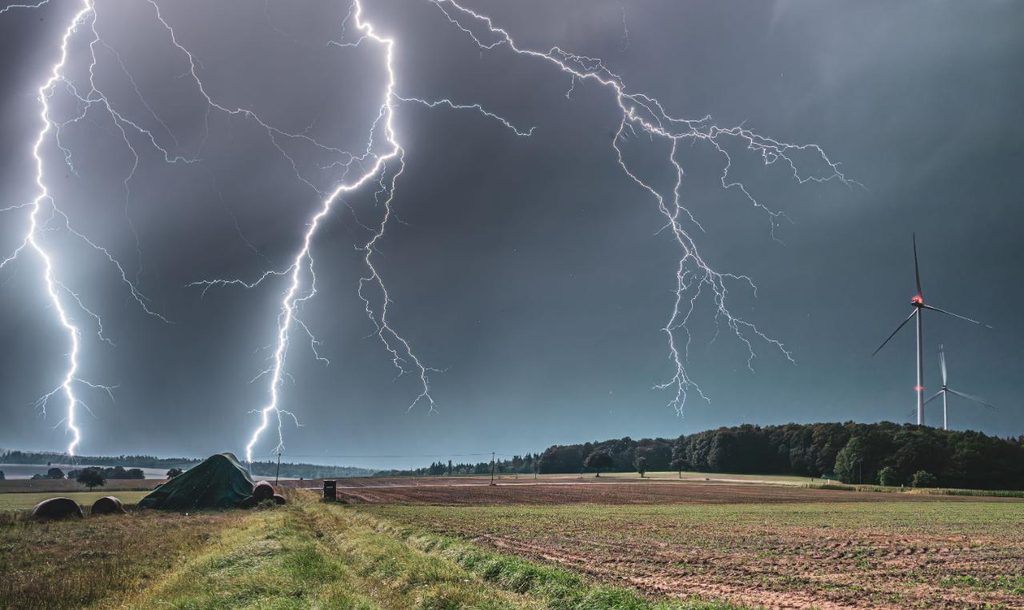
In summary, South Africa’s summer rainfall season could still produce severe localised thunderstorms, hail, strong winds, lightning and flash flooding. Although it is early in the season, recent severe weather across several provinces has already caused damage to homes and roads, highlighting how quickly conditions can change.
A challenging time for farmers
For farmers, hotter and drier conditions can put additional pressure on water resources, livestock, crops and grazing while increasing the potential for heat-related losses. At the same time, a generally drier season does not rule out sudden thunderstorms, hail, strong winds or localised flooding, which can cause significant damage to crops, infrastructure and equipment. Assess whether your agricultural insurance cover remains appropriate for the season ahead.
Prepare before the storms arrive
Now is a good time to do a pre-summer check. Take a walk around your property and look for anything that could allow rain or wind to cause damage.
- Check that windows and doors close securely and that seals are in good condition, particularly on exposed sides of the house.
- Check for cracks or gaps around windows, doors and other openings where water could enter, and make sure awnings, gutters and other external fittings are securely fastened.
- Pay particular attention to areas where rainwater can collect or flow rapidly, such as external stairwells, basement entrances, garages and sunken areas. Make sure drains and channels are clear and that water has a safe route away from the property.
- Inspect the roof for loose or damaged tiles, sheets and flashing, and make sure gutters, downpipes and stormwater drains are clear. Clear away winter leaves and other debris.
- Trim branches that could fall onto the property during strong winds and secure or store loose outdoor furniture and other items.
- Indoors, protect sensitive electrical and electronic equipment against power surges caused by lightning.
- Check ceilings and interior walls for signs of damp or water ingress, particularly around skylights, chimneys and areas below roof valleys.
- Ensure that valuable or water-sensitive items aren’t stored directly beneath areas where leaks have occurred previously.
- Make sure that emergency lighting and torches are working and fully charged in case storms cause power interruptions.
Ensure that your vehicle is prepared too
Rain can quickly turn a familiar road into a hazardous one. A few simple checks now can help you stay safer when heavy downpours occur.
- Check that your tyres have sufficient tread and are correctly inflated as worn or under-inflated tyres can reduce grip and increase the risk of aquaplaning in wet weather.
- Check your headlights, brake lights and brakes, and ensure that your windscreen washer reservoir is topped up.
- Check the rubber seals around the windscreen and door windows for signs of cracking, deterioration or gaps that could allow water into the vehicle.
- Check your windscreen wipers too – cracked, split or hardened blades can leave streaks and reduce visibility when you need it most.
- Try to remain informed about incoming bad weather so that you can stay off the roads if damaging storms or hail are on the way. Park under cover whenever possible.
In summary, weather patterns can change quickly, but being prepared doesn’t have to. Check your risks and the cover you have in place before the season gets underway to help ensure that your protection remains appropriate.
Please note: The information contained in this article is not offered as ‘advice’ in terms of the Financial Advisory and Intermediary Services Act 2002 as amended, and policyholders should consult with their intermediaries and the policy wording to ensure a full and complete understanding of the cover offered to them in terms of the Safire policy of insurance.